

Finding Strong Storms with TRMM & GPM
Spring is severe storms season here in the US, but not everyone has NEXRAD radar coverage; however, NASA’s TRMM and GPM satellites with their onboard radars have made it possible to search the entire global Tropics and midlatitudes and systematically identify areas where there are strong to intense thunderstorms. Researchers now headed by Dr. Chuntao Liu at Texas A&M University have built a comprehensive database of “precipitation features” based on regions of contiguous radar echoes from first the TRMM and now the GPM satellite. These precipitation features can then be mined to locate areas of intense convection using radar and other characteristics.
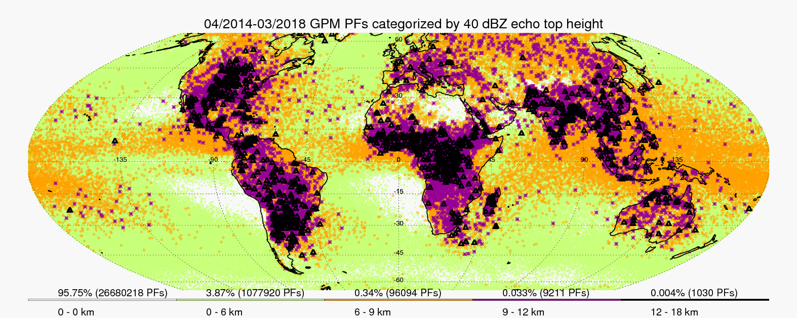 Global distribution of the maximum height of 40 dBZ radar echoes observed within precipitation features (PFs) detected by the GPM satellite’s dual polarization radar over a 4-year period. Credit: http://atmos.tamucc.edu/trmm/
One way of identifying intense convection is by seeing how high particular radar echoes reach up into the atmosphere. For example, 40 dBZ radar echoes that occur above the freezing level in the ice part of a cloud are typically associated with graupel or hail particles not snow. Graupel forms from a process known as riming when super cooled cloud droplets contact an ice particle and freeze onto it; hail particles can form as a result of heavy riming but can begin as frozen raindrops. Either way their presence is a good indication of moderate to strong updrafts, which are required to generate these particles. However, it takes a really strong or intense updraft to loft these heavier particles high into the atmosphere (e.g., 10 km).
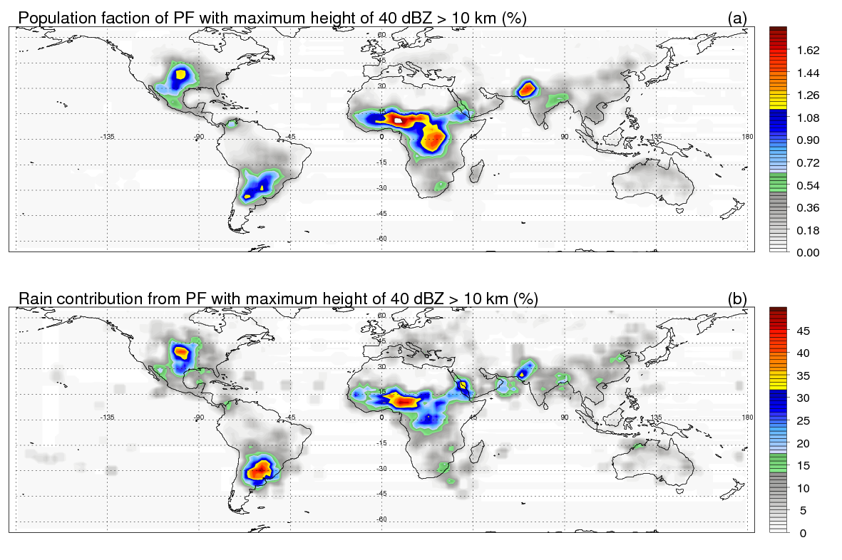 Occurrence of intense thunderstorms and their associated rainfall contribution relative to all observed precipitation features (PFs) in a given area based on 4 years of GPM dual polarization radar data. Credit: http://atmos.tamucc.edu/trmm/
Using this criterion, Dr. Liu and his colleagues are able to distinguish several hot spots around the globe were such strong storms occur. In addition to the Great Plains over the central US, such intense storms can also be found over central Africa, Pakistan and northwestern India, and southeastern South America. Partitioning the height to which 40 dBZ echoes are seen to reach in precipitation features observed around the globe can provide a global climatology of the maximum intensity that storms reach in any given area. Such a climatology shows that the vast majority of intense storms occur over land.